 Ceety BoyFrançais
How to get from Azalaï Hôtel de la Plage to Abomey-Calavi
From Azalaï Hôtel de la Plage to Abomey-Calavi: about 19.4 km by road, mostly on RNIE 2. The other way, from Abomey-Calavi to Azalaï Hôtel de la Plage: about 19.8 km.
The road route
| Direction | Road distance | Via |
|---|---|---|
| Azalaï Hôtel de la Plage → Abomey-Calavi | 19.4 km | Rue 651 A → Rue des Missions → Place de l'Étoile Rouge → Boulevard de l’Europe → RNIE 2 → RN 30 |
| Abomey-Calavi → Azalaï Hôtel de la Plage | 19.8 km | RNIE 2 → Boulevard de l’Europe → Rue 12.191 → Rue 11.056 → Avenue Dorothée Lima → Avenue du Gouverneur Van Vollenhoven → Rue des Missions → Rue 651 A |
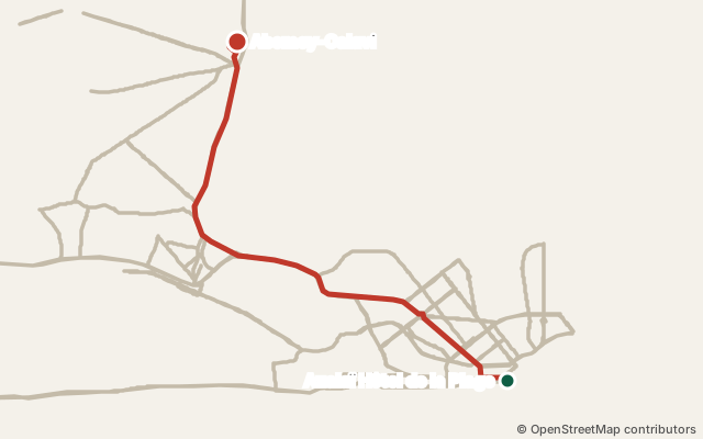
Shortest path on the OpenStreetMap road network (data of 18 October 2026), one-way streets respected; each direction is worked out on its own. It is a measurement, not an official figure. Ceety Boy gives no travel time or fare (zémidjan, taxi, bus): we cannot check them.
Start and end points
A city or neighbourhood is measured from its centre point in OpenStreetMap; your real trip depends on exactly where you start.
- Azalaï Hôtel de la Plage Hotel · GPS 6.35183, 2.43581 · the place page
- Abomey-Calavi City · GPS 6.45386, 2.35425 · the point on OpenStreetMap (node/1660451359) · Abomey-Calavi: all places