Station Sonacop de Gbégamey
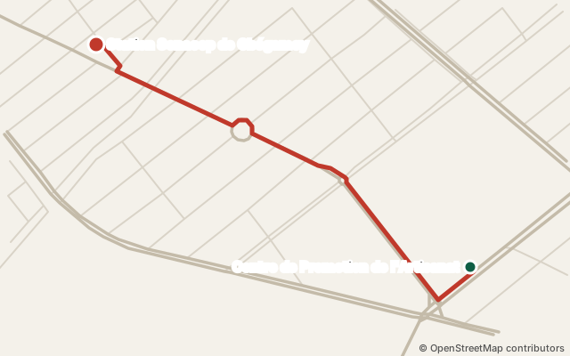
Station Sonacop de Gbégamey (fuel station) is near Gbégamè 3, in Cotonou. From Centre de Promotion de l'Artisanat: about 1.3 km by road (via Boulevard Saint-Michel, Rue du Marché, Place de Bulgarie…). Nearest landmark: Place de l'Étoile Rouge, 810 m in a straight line. OpenStreetMap data of 12 October 2026.
See the route Share on WhatsApp
How do I get to Station Sonacop de Gbégamey?
| From | Road distance | Via |
|---|---|---|
| Centre de Promotion de l'Artisanat | 1.3 km | Boulevard Saint-Michel → Rue du Marché → Place de Bulgarie → Avenue Dorothée Lima |
| Cadjèhoun | 1.8 km | Avenue du Canada → Avenue Dorothée Lima |
| Place du Souvenir | 1.8 km | Rue 12.191 → Rue 12.153 → Rue 12.080 → Rue 12.151 → Rue 12.084 → Rue 12.147 → Boulevard de France → Avenue Dorothée Lima |
| Institut Français du Bénin | 2.4 km | Avenue Pape Jean-Paul II → Boulevard Saint-Michel → Rue du Marché → Place de Bulgarie → Avenue Dorothée Lima |
- From Institut Français du Bénin: you pass near Centre de Promotion de l'Artisanat.
Landmarks
810 m in a straight line from Place de l'Étoile Rouge.
Details
- GPS coordinates: 6.36419, 2.41059 · View on OpenStreetMap
- This place on OpenStreetMap (node/6311787885)
What's nearby?
- Maquis Audréas Restaurant · 90 m in a straight line
- AKWAABA Restaurant · 90 m in a straight line
- Atacora Business Photo studio · 120 m in a straight line
- Restaurant Chez Dé Dé Restaurant · 130 m in a straight line
- Mice Cream Restaurant · 140 m in a straight line
- Bureau du 11è Arrondissement de Cotonou Town hall · 140 m in a straight line
In the guide: Fuel stations in Cotonou
Is this your place? Confirm it for free · Report a mistake · Sources and method