MRS
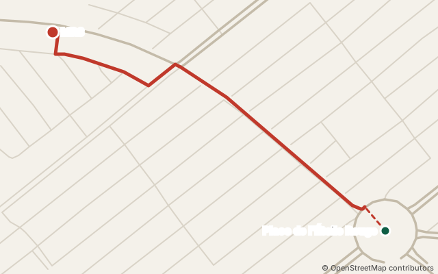
MRS (fuel station) is near Tonato, in Cotonou. From Place de l'Étoile Rouge: about 1.0 km by road (via Place de l'Étoile Rouge). Nearest landmark: Marché Sainte Rita, 710 m in a straight line. OpenStreetMap data of 12 October 2026.
See the route Share on WhatsApp
How do I get to MRS?
| From | Road distance | Via |
|---|---|---|
| Place de l'Étoile Rouge | 1.0 km | Place de l'Étoile Rouge |
| Marché Vêdoko | 1.9 km | Rue 2467 → Carrefour Védoko |
| Cadjèhoun | 2.6 km | Rue 12.191 |
| Haie Vive | 3.4 km | Rue 12.164 → Rue 12.199 → Rue 12.201 → Rue Les Cocotiers → Rue 12.191 |
- From Place de l'Étoile Rouge: the last 320 m are on small unnamed streets.
- From Marché Vêdoko: the last 1020 m are on small unnamed streets.
- From Cadjèhoun: the last 1450 m are on small unnamed streets.
- From Haie Vive: the last 1450 m are on small unnamed streets.
Landmarks
710 m in a straight line from Marché Sainte Rita.
Details
- GPS coordinates: 6.37615, 2.40191 · View on OpenStreetMap
- This place on OpenStreetMap (node/4176026779)
What's nearby?
- A TABLE Maquis Bar Restaurant Restaurant · 90 m in a straight line
- Diamond Bank · 110 m in a straight line
- Chez Maman Mélissa Restaurant · 120 m in a straight line
- PIGIER BENIN University · 140 m in a straight line
- RETROUVAILLES-SENATEUR Events venue · 160 m in a straight line
- STAR PIZZA Hotel · 160 m in a straight line
In the guide: Fuel stations in Cotonou
Is this your place? Confirm it for free · Report a mistake · Sources and method