La Capucine
La Capucine (nursery school) is near Agata, in Cotonou. From Ladji: about 1.4 km by road (via Rue 6.001, Rue 6.104). Nearest landmark: Ladji, 1.1 km in a straight line. OpenStreetMap data of 12 October 2026.
See the route Share on WhatsApp
How do I get to La Capucine?
| From | Road distance | Via |
|---|---|---|
| Ladji | 1.4 km | Rue 6.001 → Rue 6.104 |
| Marché Dantokpa | 2.2 km | Rue 6.088 → Avenue de la Libération (6.043) |
| Marché Saint-Michel | 2.3 km | Avenue de la République → Carrefour Lègba → Avenue de l'Ouémé → Avenue de la Libération (6.043) |
| Place de l'Étoile Rouge | 2.5 km | Place de l'Étoile Rouge → Rue 560 → Carrefour 16 Ampoules → Rue 6.106 → Rue 6.063 |
- From Ladji: the last 230 m are on small unnamed streets.
- From Marché Dantokpa: the last 80 m are on small unnamed streets.
- From Marché Saint-Michel: the last 80 m are on small unnamed streets.
- From Place de l'Étoile Rouge: the last 500 m are on small unnamed streets.
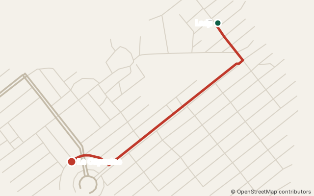
Landmarks
1.1 km in a straight line from Ladji.
Details
- GPS coordinates: 6.38400, 2.42349 · View on OpenStreetMap
- This place on OpenStreetMap (node/4189562797)
What's nearby?
- Chez le Vieux Père Fast food · 40 m in a straight line
- La Grâce de Dieu Dry cleaner · 50 m in a straight line
- ESPACE BOB DESIGN Clothes shop · 50 m in a straight line
- Imprimerie ASTRID Groupe Copy shop · 50 m in a straight line
- LE MOOD ( Bar et restaurant) Bar · 60 m in a straight line
- Buvette Chez le Mabé Pub · 80 m in a straight line
In the guide: Schools in Cotonou
Is this your place? Confirm it for free · Report a mistake · Sources and method